



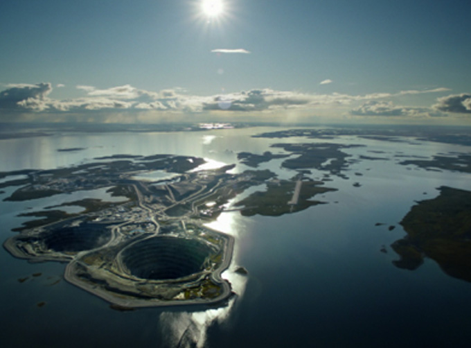


INSURANCE SATELLITE REMOTE SENSING
Prix : 1-12 USD/km²
Combining satellite and remote sensing technologies with rights confirmation data and land parcel segmentation technology can vectorize and spatialize the subject matter of insurance, then establish a spatial database of the subject matter of insurance to provide spatial data and analysis management support for insurance underwriting and claim settlement.
SATELLITE REMOTE SENSING FOR AERIAL IMAGERY ANALYSIS INSURANCE FEATURES
1
Accurate Risk Assessment: Satellite aerial imagery analysis insurance can provide detailed information on properties, such as their size, shape, location, and condition. This can help insurers to accurately assess the risks associated with a property and determine appropriate coverage and premiums.
2
Data breach coverage: Satellite aerial imagery analysis insurance often involves handling sensitive data, which can be vulnerable to cyber attacks. This aerial imagery insurance can provide coverage for data breaches and associated costs, such as legal fees, notification expenses, and credit monitoring services.
3
Data Analytics and Predictive Modelling: Satellites used for remote sensing in insurance can provide insurers with a wealth of data that can be used to develop predictive models and identify patterns and trends. This can help insurers to better understand risks and make more informed decisions about coverage, premiums, and underwriting.
4
Improved Underwriting: Satellite aerial imagery analysis insurance can help insurers to identify and evaluate risks that may not be visible through traditional methods, such as physical inspections or surveys. This can lead to more accurate underwriting and better risk selection.
5
Enhanced Customer Experience: By leveraging satellite aerial imagery analysis, insurers can provide their customers with more personalized and customized insurance solutions, based on the specific risks associated with their properties. This can lead to increased customer satisfaction and retention.
changguang Jilin satellite constellation is the core project under construction by CGSTL. The first phase of the project consists of 138 high-performance optical remote sensing satellites covering video, high resolution, wide band, infrared, multispectral and other series.
Personne à contacter : global jl1, 0431 81785188
Bonne affaire : acheter au vendeur
Nous vous invitons à lire nos conditions générales d'utilisations. Vous pouvez aussi vous rendre sur nos FAQ et consulter notre page d'informations sur les risques liés à la contrefaçon.
|
Cette page concerne les importateurs et exportateurs de INSURANCE SATELLITE REMOTE SENSING Rechercher dans la catégorie : Pro / B2B Rechercher dans la catégorie : remote, sensing, satellite, insurance |
 52200 Décoration / Objets
Signalez un abus
Tuesday 29 September 2026
Nos produits sont taillés dans un marbre fossilisé datant de l'ère primaire (450 millions d'années). Nos artisans ont apporté le plus grand soin et leur savoir-faire ancestral lors de son extraction, de sa taille et de son polissage en mettant en valeur les ammonites et les orthocères...
la pierre d'erfoud sarl
- pierrederfoud
- 52200 - erfoud
- +212661997865
 999077 High Tech
Signalez un abus
Thursday 01 August 2013
Quantité : moq:1pcs - Prix : USD154.6
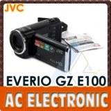
The black JVC GZ-E100 Full HD Everio Camcorder shoots Full HD 1920 x 1080 video. It features an SD/SDHC/SDXC memory card slot, back-illuminated 1/5.8" 2.5-megapixel CMOS image sensor and Konica Minolta HD lens. The high-quality HD lens supports 40x optical zoom, 70x Dynamic Zoom...
AC Electronic Ltd
- 999077 - HongKong
- +85 2 23 25 18 67
- +86 13501567844
 13004 High Tech
Signalez un abus
Tuesday 29 September 2026
Quantité : 10000 - Prix : 5€
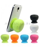
silicone ventouse étanche Haut-parleur Bluetooth Matériel: gel de silicone USB Longueur du câble : environ 76cm Article Dimension : environ 62 x 62 x 61 mm Dimension de l'emballage : environ 211 x 175 x 51 mm paramètres: Une . Boutons / Interfaces : bouton ON / OFF , Interface USB Micro ...
MaciMax intelligent téléphone accessoires grossiste
- hjb810410
- 13004 - Marseille
- 04 91 92 53 77
Paiement sécurisé
